DUG
NASWOGS
Forum Supporter
2021 Supporter
2022 Supporter
2023 Supporter
2024 Supporter
Trading Post Subscriber
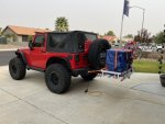
My granddaughter is in town for her summer visit so we decided to take the Jeep out for a week and hit some trails in Colorado. It would also be a great excuse to take all the crap my son left behind when he moved out several years ago and drop it off in Denver. So we bought the finest hitch rack Harbor Freight had in stock, loaded up his stuff and filled the Jeep with some spare parts, tools, recovery gear and camping gear.
We planned on heading to Denver, hanging out for a day and then making our way to our first trail up to Holy Cross City. That’s supposed to be one of the toughest in Colorado. From there we would camp outside of Silverton in the San Juans for three more days. We also wanted to hit up Hole in the Rock trail (not road) in Utah, but the Jeep gods didn’t allow that to happen.
The first concern was all of the rain hitting Colorado. I70 closed a week before we were leaving and didn’t reopen, resulting in a lengthy detour. The San Juan’s were also experiencing heavy rains and mudslides. We headed south at Grand Junction instead of the suggested route. Waze doesn’t understand that my Jeep really only likes 75ish mph, so a longer route with higher speeds isn’t helpful. From Mesquite it took us 12 full hours to get to my sons place.
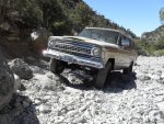
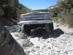
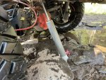
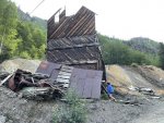
After an enjoyable visit and ditching the hitch rack we rolled out of Denver at 0430 for Holy Cross. It’s not an ideal trail to run solo, but I resolved not to do anything stupid. We started off pavement a little after 0700 after airing down and adjusting shocks. We ended up pulling cable a couple miles in and winching up a big obstacle because it was too early in the trip to skinny pedal up. I tried it three times and probably could have got it with a little more pedal power, but stayed conservative. The water crossing is known for requiring a winch but we picked a good line and got lucky. Not long after that I heard a horrible noise and discovered a lower shock bolt had broken and allowed the shock to drag and bend at the rear sway bar. Ive broken a shock bolt before on the Rubicon trail so now I carry a spare. We got it remounted but the bend limited it’s travel. We made it to the ghost town right after repairs and we decided to skip the last 2 tenths of a mile of the trail and head back down. At the stream crossing my wet tires slipped off of a waist high boulder and we were wedged and high centered. Again the Warn winch set us free. With no other issues we aired up and hit the pavement at around 1 pm, determined to make it to our planned campsite in Silverton that day.
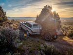
Because we worried about rain, we had ditched the usual cots and brought tents, a rarity for us. We turned in after a late dinner just before 10 pm. The next day we met up with an old friend of mine, an ultra runner, pro photographer and Silverton local. He would be running trails with us the next two days in his stock 2009 TRD Taco with 375,000 miles on it. I’m not kidding when I say it was tough to keep up with him. He knows every trail and everyone in town.
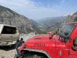
Day one was the classic Alpine Loop, starting with Cinnamon to Lake City and back over Engineer. He is dealing with some cancer issues and tires easily right now so sight seeing was limited to the passes and a tour of Lake City. He directed us to the best restaurant in town and we finished our day checking out Silverton. Our second day in Silverton started same as the first, meeting my buddy at the coffee shop and following him to the trails. We started with Black Bear Pass which was breathtaking. He showed us around Telluride and then we took on Imogene Pass to make our way back to Silverton. Good scenery, but not as nice as Black Bear Pass.
We heard that Silverton might get rain that night so my buddy gave us the phone number for his friend’s B&B and he led us there after safety getting off the trail. The granddaughter and I did more tourist stuff in Silverton and even got to watch a Wild West shoot out. Our last day in Silverton was great because we got to sleep in until almost 0800. We headed towards Ouray and met up with a retired couple from Texas who wanted another rig to run Poughkeepsie with. My buddy’s Taco was awesome, but it isn’t up to rock crawling. Our new friends had us lead and we easily made our way to the feared obstacle on Poughkeepsie - The Wall. It’s supposed to be a killer, but we walked right up it. There must be 3-4 winch points if you need them, but maybe that’s if it’s wet or something. The retired folks got their JKU high centered briefly but we spotted them towards a better line and they tackled it easily on the next attempt. We made our way back to town, aired up and had lunch at our favorite restaurant, eating there for the third day in a row.
It was time to leave Silverton so we headed out over Ophir Pass. When we got to the other side I realized we never left 2wd. Not a super tough trail. From there we were supposed to head to Halls Crossing to do the Hole in the Rock trail, which is often confused with the Hole in the Rock road on the other side. The road is several hours of 2wd, the trail is 2-3 days in 4wd. With the shock damage I just didn’t want to be 35+ miles off pavement solo. Besides, it had been a long week already. So from Ophir we headed towards Mesquite.
The curious route Google maps took us on had us going into Utah and Arizona three times each, but it was worth it for the light traffic and fantastic views. If you’re a Jeeper you probably already picked up on the fact that we completed all six Badge of Honor trails in Colorado. Planning another visit to Moab next month after my rear shock is rebuilt and I’m getting a PSC hydro assist steering put on later this week. Sorry for the super long read, our overseer Titan thought some people here are interested in off road stuff in addition to guns and ammo.


Last edited:


